Sunday, March 15, 2026
It is a day of dramatic atmospheric contrasts across the country. While some regions are bracing for winter’s fiercest grip, others are shattering heat records, only to face a staggering temperature plunge by nightfall.

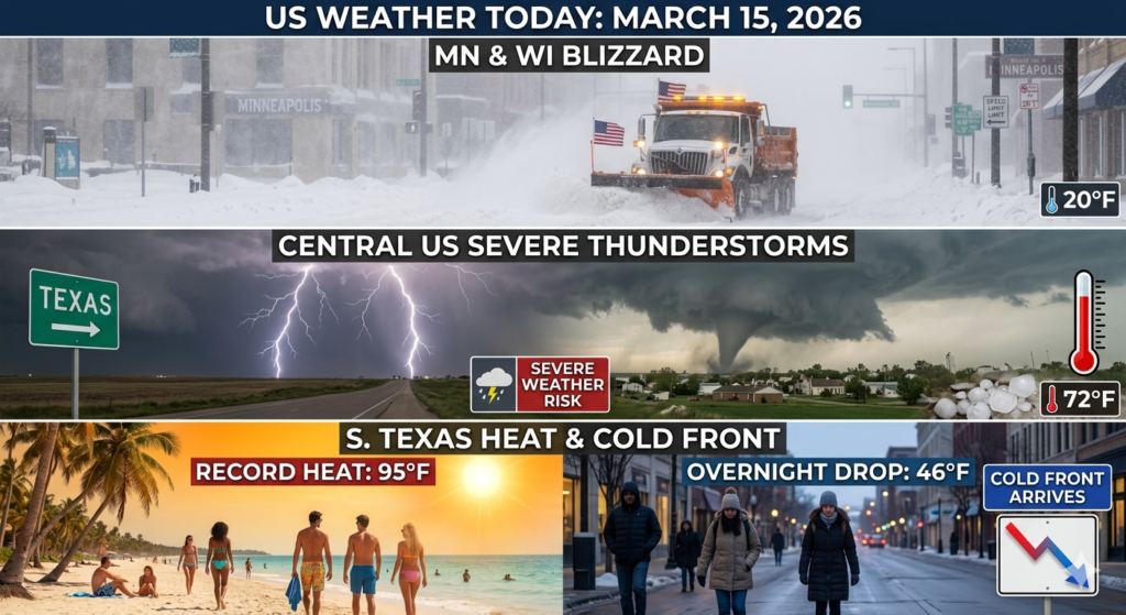
The Deep Freeze: Northern Plains & Midwest
Minnesota and Wisconsin are at the heart of a major March snowstorm. Residents are seeing snowfall totals exceeding 1 foot, with isolated pockets reaching up to 18 inches.
• Conditions: Blizzard warnings are in effect as wind speeds of 30–50 mph create dangerous whiteout conditions.
• Impacts: Travel is heavily disrupted, with significant flight cancellations at Minneapolis-St. Paul International Airport.
The Severe Threat: Central U.S. to the East
A potent line of thunderstorms is carving its way from Illinois down to Texas.
• Risks: The National Weather Service has flagged an enhanced risk (Level 3 of 5) for severe weather.
• What to Watch For: Damaging wind gusts up to 70 mph, large hail, and isolated tornadoes are possible through tonight.
The Heat & The Drop: South Texas
In a display of seasonal “whiplash,” parts of South Texas are experiencing record-shattering heat today, with highs climbing into the mid-90s. However, don’t let the sun fool you—a powerful cold front will arrive this evening, causing temperatures to plummet by nearly 50 degrees by sunrise tomorrow.
The Quiet West
The Rockies and the West Coast remain the outliers today, staying primarily dry and tranquil, though light rain is expected to move into western Washington late this evening.
Safe Travels: If you are in the path of the blizzard or the severe storm line, stay weather-aware and keep your emergency alerts active.